Load HEC-RAS 2D Results Summary Layers
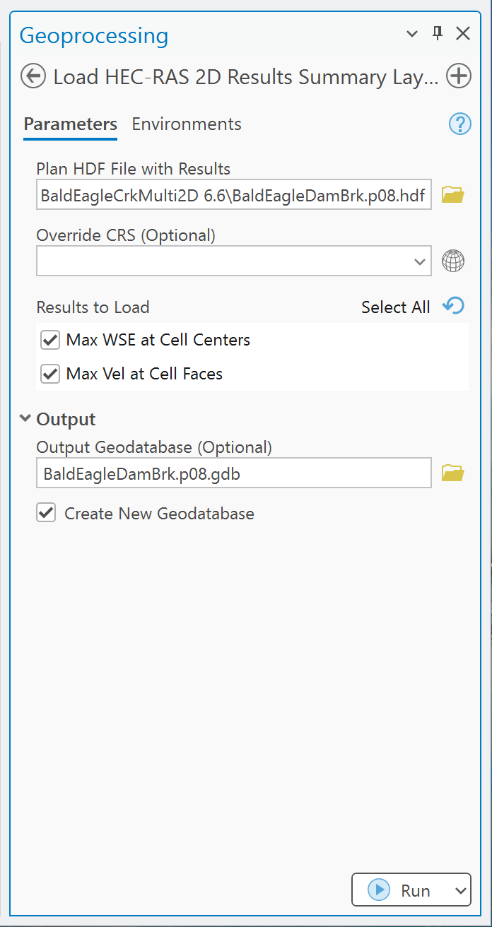
Use this tool to create GIS point layers for maximum water-surface elevation at 2D cell centers and maximum velocity at cell-face centroids.
Required input
Select a computed plan HDF such as Project.p01.hdf. A geometry HDF does not contain the required
summary results. The plan must contain the HEC-RAS unsteady 2D summary-output groups used by the
tool.
Parameters
| Parameter | Required | Behavior |
|---|---|---|
| Plan HDF File with Results | Yes | Reads summary results and the associated 2D geometry from p*.hdf. |
| Override CRS | No | Used only if automatic CRS detection fails; it does not reproject a detected CRS. |
| Results to Load | Yes | Select maximum WSE, maximum face velocity, or both. Defaults to maximum WSE. |
| Output Max WSE at Cell Centers | Conditional | Point output for each cell with a supported maximum WSE record. |
| Output Max Vel at Cell Faces | Conditional | Point output at each supported cell-face centroid. |
| Output Geodatabase | No | Persistent file geodatabase destination. |
| Create New Geodatabase | No | Enabled by default; creates/reuses Project.pXX.gdb. |
Procedure
- Confirm that the intended HEC-RAS plan computed successfully and that its HDF results are current.
- Open Load HEC-RAS 2D Results Summary Layers and select the plan HDF.
- Choose one or both result types.
- Set Override CRS only if automatic detection fails.
- Keep automatic geodatabase creation enabled for a persistent output.
- Run the tool and review messages for each 2D flow area.
- Compare several locations and values with RAS Mapper before using the layer for mapping or analysis.
Output fields
| Output | Geometry | Fields |
|---|---|---|
MaxWSE |
Point at cell center | mesh_name, cell_id, max_wse, max_wse_time |
MaxVelocity |
Point at cell-face centroid | mesh_name, face_id, max_vel, time_of_max |
The HDF summary datasets store a maximum value and the time offset at which it occurred. The tool adds that offset to the simulation start time and writes an ArcGIS date field.
Units and interpretation
- WSE and velocity remain in the source model's unit system. No conversion is performed.
- Maximum WSE and maximum face velocity are independent summaries; their timestamps need not match.
- Face velocity is represented at a point derived from the face geometry, not as a cell-average velocity polygon.
- The tool does not calculate depth, hazard classifications, inundation polygons, or full time series.
- Review unexpected sentinel/NoData values from the source HDF before symbolizing or calculating statistics.
Common checks
- Confirm the plan number, simulation window, and compute status.
- Compare the number of WSE points with the available cell centers for each mesh.
- Compare sample maxima and times with RAS Mapper.
- Verify the model unit system before labeling legends or exporting tables.
- Confirm the CRS and layer alignment before raster interpolation or spatial joins.
For a broader result workflow, use the full RAS Commander guide.